
Real estate photography · Central Kentucky
Show buyers the whole property — not just the road frontage.
Aerial photos and listing video for farms, acreage, and rural homes across Nelson County, Bardstown, and the Louisville area.
[ROB: drop a full-width farm / acreage aerial into this Cover block] · Part 107 pilot · DJI Mavic 4 Pro · Sony A7V
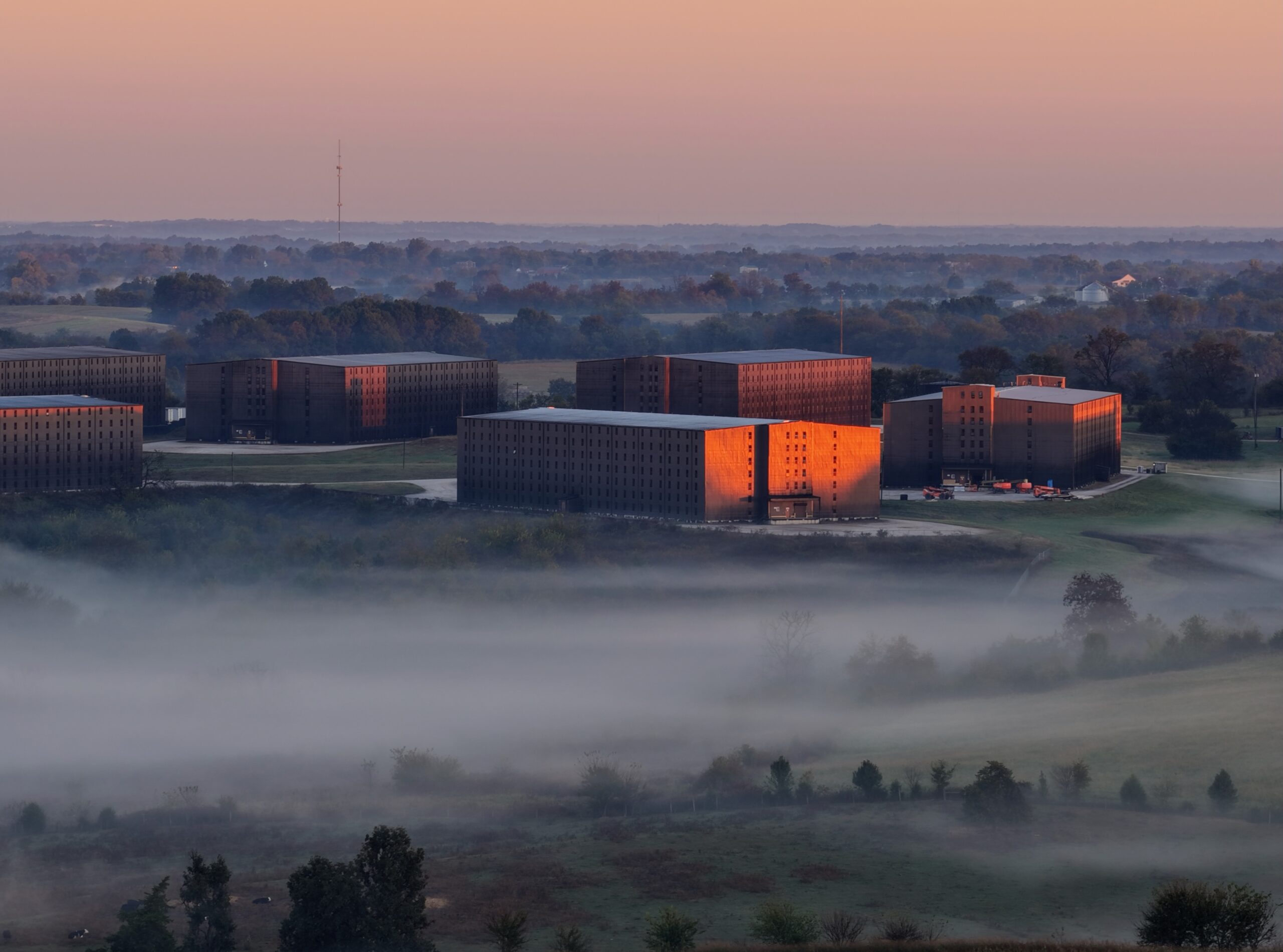
[ROB: hero photo — sunrise / low-fog aerial of a Kentucky farm or acreage. Upload and set as Cover image above; you can delete this placeholder strip.]
Services
Media built for rural listings and land
Most land can’t be shown from the road. A drone shows the fields, tree lines, water, outbuildings, and access a buyer is actually paying for.
Real Estate Photography
Listing-ready photos of the home, lot, and setting — with drone stills that place the house on its land.
- Exterior stills [ROB: confirm interiors]
- Aerial stills of home, lot, and approach
- MLS-ready sizing
[ROB: package names — no prices invented]
Drone Photo & Video
Short aerial edits for MLS, YouTube, and social — plus longer property tours for farms and estates. Flown on a DJI Mavic 4 Pro.
- Short-form aerial clip for social
- Longer property tour edit
- [ROB: confirm vertical cut for Reels/Shorts]
Rural Acreage & Farm Walkthroughs
Multi-angle aerials of farms, hunting ground, and large lots — fields, timber, ponds, creeks, frontage, and outbuildings.
[ROB: confirm approximate property-line overlays if offered]
Land Marketing
A clear overhead look for agents, sellers, and buyers — layout, access, drainage patterns, and neighbors in context.
Photos and video only. Not a survey, appraisal, or inspection.
Turnaround: [ROB: e.g. edited photos in X hours] · Usage rights: [ROB: what clients can use files for]
Portfolio
Recent work
Replace these tiles with real listing and acreage stills. Captions stay plain — property type, county, what was delivered.
[ROB: add at least one real listing or acreage reel — YouTube embed OK]
Service area
Based in Nelson County, flying central Kentucky
Home base near Bloomfield / Bardstown, close to Louisville. Happy to talk about shoots farther out — [ROB: confirm radius and any travel fee].
Towns: Bloomfield · Bardstown · Louisville metro · Taylorsville · Shelbyville · Springfield · Shepherdsville / Mt. Washington · Elizabethtown · Lebanon
Counties: Nelson, Spencer, Bullitt, Jefferson, Shelby, Washington, Marion, Hardin, and nearby. [ROB: confirm list]
[ROB: map image or embed centered on Bloomfield / Bardstown, KY]
[ROB: headshot — ideally with the drone in the field]
About
Hi, I’m Rob Higdon
I’m a drone and real estate media pilot in central Kentucky. I focus on what’s hard to show from the ground: farms, acreage, and rural homes where the land is the selling point.
I’m a Part 107 certified remote pilot. I fly a DJI Mavic 4 Pro and shoot stills on a Sony A7V. On YouTube I share what I’m learning about airspace, FAA rules, and rural shooting as Next Move with Rob.
[ROB: your own bio in your words — background, why rural real estate, local roots, what clients can expect.]
[ROB: confirm insurance wording if you want it listed] · [ROB: confirm Part 107 display]
YouTube
Next Move with Rob
Drone law, airspace, and rural property shooting — straight talk from the field in Kentucky.
[ROB: embed 1–2 favorite videos here with YouTube block]
Free for drone pilots
Get the free drone templates
Ready-to-load DJI waypoint templates and field checklists I built for real rural real estate jobs in Kentucky. Drop your info and I’ll send them to your inbox.
- Acreage walkthrough KMZ
- Roof inspection mission
- Grid mapping starter
- [ROB: confirm what’s in the free pack]
Templates are starting points — always check airspace, obstacles, and heights for your own site before flying.
Send me the templates
Book a shoot
Tell me about the property
Send the address or parcel, acreage, listing date, and what you want highlighted. I’ll follow up with availability and a quote — [ROB: no prices listed here until you set them].